






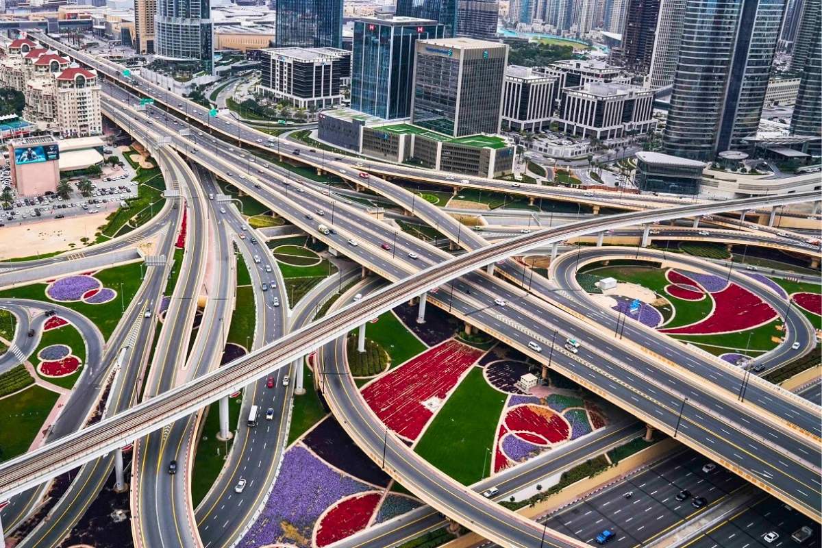
Dubai is executing an aggressive transformation of its surface transportation grid under the Dubai Roads and Transport Authority (RTA) Strategic Plan. Spanning 57 specialized infrastructure projects across 226 kilometers of roadways and 115 new bridges and tunnels, the multi-billion-dirham initiative is engineered to future-proof the emirate’s mobility framework as Dubai’s resident population expands toward an estimated 7.8 to 8 million by 2040 under the Dubai 2040 Urban Master Plan.
A central pillar of the master plan is the modernization of 11 strategic road corridors – comprising eight vertical arterial axes connecting coastal districts to interior desert developments and three major east-west bypass routes. These projects integrate directly with ongoing municipal mobility investments, including Dubai’s Dh633 Million corridor traffic overhauls and national transit links like the UAE Etihad Rail passenger network.
Major Road Corridors Under Development (2025-2027)
| Corridor Project | Length / Scope | Capacity Increase | Travel Time Reduction | Target Population Served |
|---|---|---|---|---|
| Umm Suqeim – Al Qudra Corridor | 16 km, 7 km bridges/tunnels, 4 interchanges | 8,400 to 12,600 vehicles/hr (+50%) | 46 mins to 11 mins (-76%) | Over 1,000,000 residents |
| Hessa Street Improvement Project | 4 major flyover interchanges, 9 km bridges | 4,000 to 8,000 vehicles/hr (+100%) | 30 mins to 7 mins (-77%) | 640,000 residents |
| Al Fay Road Corridor | 12.9 km roadway, 13.5 km bridges (5 junctions) | +64,400 vehicles daily capacity | Major bypass for E311 & E611 | 600,000 residents |
| Latifa bint Hamdan Street | 12.2 km route linking Al Khail to Emirates Road | Direct multi-lane flow | 55% reduction in bottle-neck delays | Barsha & Al Quoz industrial zones |
| Trade Centre Roundabout | 5 elevated bridge flyovers replacing roundabout | Double current junction throughput | Eliminates 18-minute signal delays | DIFC, Za’abeel & Downtown Dubai |
Deep Dive: Upgrading Dubai’s Most Congested Arteries
1. The Hessa Street Overhaul
Hessa Street serves as the primary east-west lifeline connecting residential hubs such as Al Barsha, Jumeirah Village Circle (JVC), Jumeirah Islands, and Dubai Sports City with Sheikh Zayed Road (E11) and Mohammed bin Zayed Road (E311). By replacing signalized roundabouts with two-tier flyovers and widening carriageways to four lanes in each direction, the RTA has doubled capacity to 8,000 vehicles per hour.
In addition to vehicular flow, the project introduces a 13.5-kilometer dedicated cycling and e-scooter track, featuring two architectural pedestrian bridges that span Sheikh Zayed Road and Al Khail Road, fostering multi-modal first-and-last-mile connectivity.
2. Umm Suqeim – Al Qudra Expressway
Connecting coastal Jumeirah Street directly to Emirates Road (E611), this 16-kilometer artery handles heavy residential and commercial logistics. The development features 7 kilometers of subterranean tunnels and elevated bridges across four major interchanges. Journey times across the corridor are projected to collapse from 46 minutes down to just 11 minutes.
3. Trade Centre Roundabout Modernization
The iconic Dubai World Trade Centre (DWTC) roundabout – one of the emirate’s historic traffic bottlenecks – is being transformed into an intelligent, high-throughput junction. The project introduces five elevated flyover bridges spanning 5,000 meters to separate through-traffic moving between Sheikh Zayed Road, 2nd December Street, and Zabeel Palace Street from local exhibition traffic.
Smart Mobility: Dynamic Tolling & AI Traffic Optimization
Physical road widening represents only one half of the RTA’s congestion management formula. The authority has paired corridor engineering with real-time digital demand management:
- Dynamic Salik Tolling: Variable pricing at key bottlenecks discourages discretionary trips during morning and evening rush hours, shifting up to 9% of peak volume to secondary routes or public transit.
- AI Radar & Lane Enforcement: Working closely with law enforcement, new AI radars target hazardous driving habits such as tailgating and dangerous lane cutting, reducing incident-induced gridlock.
- Parkin Tariff Rationalization: Restructuring parking tariffs through Parkin subscription and peak-rate models incentives commuters to utilize park-and-ride facilities near Dubai Metro Red and Green Line stations.
Economic & Real Estate Impact on Dubai Communities
The completion of these 11 corridors directly influences property valuations and daily living standards across inland Dubai. Master-planned communities historically hindered by single-point bottlenecks – including Damac Hills, Arabian Ranches, JVC, and Dubai Silicon Oasis – stand to see substantial commute reductions. Commercial logistics operators running heavy freight between Jebel Ali Port and the northern emirates will also save millions of operational hours annually by bypassing urban core chokepoints.
Frequently Asked Questions (FAQ)
When will the Hessa Street improvement project be fully completed?
Major bridge flyovers and newly widened sections of Hessa Street have opened progressively in phases, with final interchange completion and landscaping slated for completion by late 2025.
How does the RTA Strategic Plan align with the Dubai 2040 Master Plan?
The road network expansion is designed around the 20-minute city concept: ensuring that 80% of residents can reach their daily service needs and work hubs within 20 minutes through an integrated network of expressways, mass transit, and micro-mobility lanes.
Will new Salik toll gates be added as part of these corridor upgrades?
The RTA evaluates new Salik toll locations based on comprehensive traffic modeling to manage arterial load distribution, with dynamic tariffs deployed to maintain steady vehicle flow without restricting essential commerce.