






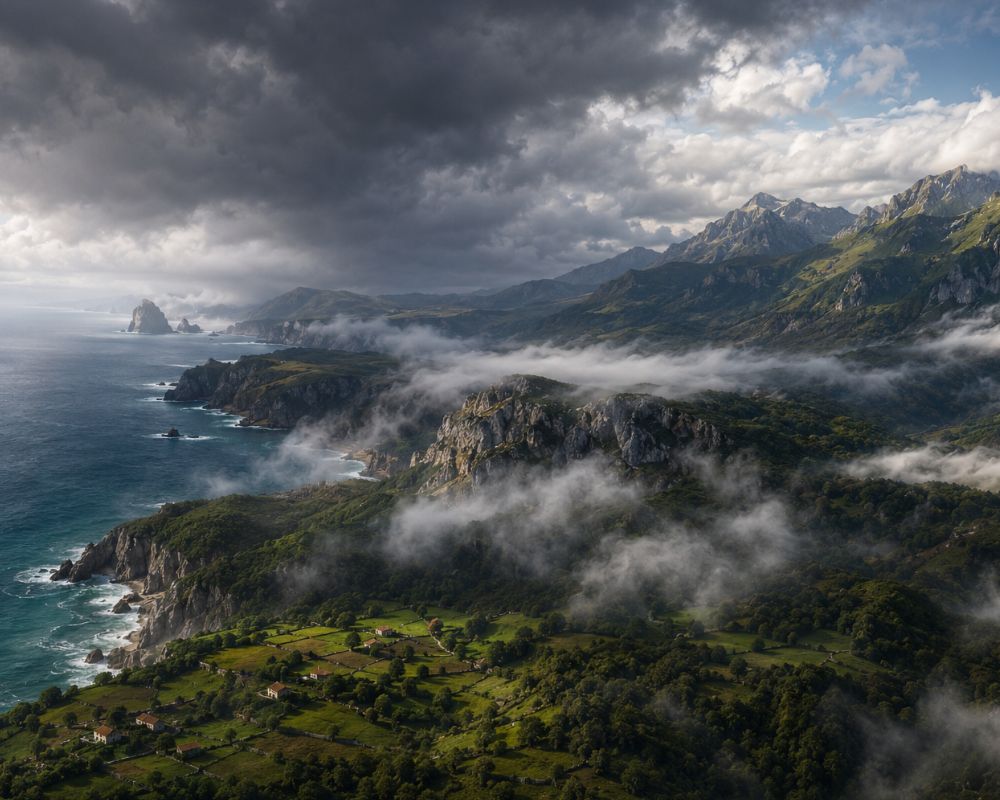
According to historical AEMET data, travellers evaluating the 2026 solar eclipse Spain weather forecast face a 60% to 65% cloud risk along northern Spain’s Bay of Biscay coast. Moving just 15 to 25 kilometres inland past coastal mountains lowers that sunset cloud cover risk to under 20%.
Why Does Sunset Totality Trigger Instant Coastal Fog in Northern Spain?
The sudden 2°C to 4°C temperature drop during the August 12, 2026, solar eclipse collapses the land’s thermal barrier, forcing humid ocean air inland and triggering sea fog along the coast.
As the moon’s shadow crosses northern Spain between 7:30 PM and 8:30 PM local time, surface land temperatures fall rapidly within minutes. In solar astronomy, totality refers to the brief phase of a solar eclipse when the moon completely blocks the sun’s visible disc.
This sudden cooling alters the local thermal balance. Normally, warm air over the land holds off the cooler maritime air mass sitting over the Bay of Biscay. When the eclipse rapidly chills the coastal land surface, that thermal barrier collapses.
The temperature inversion forces humid ocean air inland while accelerating condensation along the surface. In northern Spain, this phenomenon is known as a ‘galerna’, a sudden marine weather event characterised by rapid squalls, temperature drops, and sea fog along the Cantabrian coast. Instead of clearing the sky, the arrival of totality acts as the atmospheric trigger that forms low stratus clouds and dense sea-fog right at sunset.
Climatological surveys published in Eclipsophile’s TSE2026 Meteorological Analysis document that low-level marine inversions along the Biscay coast consistently produce cloud amounts exceeding 65% during late afternoon thermal shifts.
What Do AEMET Weather Records Show for Northern Spain Eclipse Totality Locations?
Historical synoptic weather observations from Spain’s State Meteorological Agency (AEMET) reveal that coastal locations face a 58% to 65% chance of evening cloud cover, while inland plateau stations drop to 15% to 18%.
Synoptic weather observations are standardised meteorological reports collected simultaneously across multiple monitoring stations to track surface atmospheric conditions. An analysis of hourly synoptic records highlights a sharp divergence in sky conditions during the exact evening hours of totality:
According to AEMET OpenData records from 1995 to 2025, coastal observation stations regularly experience heavy cloud cover and low visibility between 7:00 PM and 8:30 PM in mid-August:
- A Coruña (Coastal): Historical August evening cloud cover probability of 62%, with visibility below 2 kilometres occurring in 18% of observations.
- Santander (Coastal): Historical August evening cloud cover probability of 65%, driven by frequent afternoon marine layer intrusion.
- Bilbao (Coastal Valley): Historical August evening cloud cover probability of 58%.
- Burgos (Inland Plateau): Historical August evening cloud cover probability of 18%, with clear sky classifications in 74% of records.
- Valladolid (Inland Plateau): Historical August evening cloud cover probability of 15%, offering the lowest overall cloud risk along the northern track.
The data confirms that remaining directly on the coast during late afternoon creates a three-to-one disadvantage for sky visibility compared to inland locations.
Why Is Tourism Marketing Ignoring Coastal Microclimate Weather Risks?
Promotional campaigns from regional tourism boards prioritise hotel infrastructure and transport links over meteorological data, directing visitors to high-risk oceanfront sites like A Coruña and Santander.
Regional itineraries highlight coastal esplanades, historic lighthouses, and oceanfront vantage points as primary spectator spots. Maps from the European Space Agency (ESA) confirm that northwestern coastal hotels are seeing surging demand despite the high probability of Atlantic low-stratus interference. Hotel bookings across A Coruña and Santander have already passed 85% capacity for the week of August 12.
Tourism operators defend their coastal positioning by pointing to superior hotel density, high-speed rail links, and emergency service infrastructure. However, these promotional campaigns rarely incorporate AEMET’s historical microclimate risk data into their primary travel advisories.
Where Is the Inland Topographic Shield Against Marine Fog?
The Cantabrian mountain range forms a natural barrier roughly 15 to 25 kilometres inland, blocking low-altitude sea fog and creating a dry rain-shadow zone with significantly higher sky visibility.
A rain-shadow microclimate is a dry local weather zone formed on the leeward side of a mountain range that blocks rain-bearing clouds and moist ocean air. Topography provides a natural atmospheric barrier against coastal fog intrusion along northern Spain’s solar eclipse cloud cover corridors.
According to satellite boundary-layer tracking from EUMETSAT archives, maritime stratus clouds rarely penetrate past the northern ridge of the Cantabrian Mountain range during rapid evening temperature drops.
Travelling roughly 15 to 25 kilometres inland past this ridge places observers in a distinct rain-shadow microclimate. Once behind the mountain crest, maritime humidity drops by more than 35%, and the probability of eclipse-induced fog formation falls to match the dry baseline of the southern plateau.
Key inland access routes such as the AP-66 and A-67 highways pass directly through these mountain cuts, allowing observers to shift from coastal zones to inland viewing sites within 30 to 45 minutes.
How Do Solar Eclipses Change Local Weather Patterns?
Solar eclipses cause rapid surface cooling that drops air temperatures down to the dew point, creating sudden cloud layers along coastal boundaries within minutes of totality.
Shadow-induced weather shifts are well-documented in atmospheric science. During the total solar eclipse of August 11, 1999, which crossed the United Kingdom and western Europe, meteorological stations recorded sudden marine stratus formation along the English Channel and Normandy coast.
In that event, ambient air temperatures dropped by 3.1°C across coastal zones within 20 minutes of totality. The drop brought air temperatures down to the dew point, creating localised cloud layers over areas that had been clear two hours prior.
The August 2026 path presents an identical thermodynamic setup. The challenge is compounded by the sun sitting low on the horizon at just 8 to 10 degrees, meaning even shallow low-altitude fog can completely block visibility.
How Should Travellers Plan Their Escape Routes on Eclipse Day?
Travellers should monitor real-time satellite imagery four hours before totality and use inland highway corridors like the AP-66 and A-67 to cross mountain passes before noon to beat congestion.
Achieving a clear view of the eclipse along the northern corridor requires dynamic positioning rather than remaining at a stationary coastal hotel. Transportation models for the regional road network show that coastal highways like the A-8 will face severe congestion if thousands of viewers attempt to move inland simultaneously two hours before totality.
Regional traffic authorities plan to deploy extra patrols along key mountain passes. Travellers based on the coast must plan their highway transit toward the interior plateau before noon on August 12, well ahead of the evening thermal shift.
Monitoring live satellite imagery from EUMETSAT and local AEMET weather radar starting at 4:00 PM local time will reveal whether the maritime boundary layer has begun its inland move, providing a three-hour decision window before the shadow arrives.
Frequently Asked Questions
What is the cloud cover risk along northern Spain’s coast during the 2026 solar eclipse?
Historical 30-year AEMET weather records show a 60% to 65% probability of cloud cover or sea fog along coastal cities like Santander and A Coruña during late afternoon totality. This risk is driven by moist Atlantic air masses and eclipse-induced thermal drops.
Why is inland Spain safer for viewing the 2026 total solar eclipse?
Inland plateau locations like Burgos and Valladolid sit behind the protective barrier of the Cantabrian Mountains, dropping evening cloud probability to 15% to 18%. The mountains block low-level marine stratus clouds from penetrating into the interior.
What causes a sudden galerna fog during a late-afternoon solar eclipse?
As the moon’s shadow drops land temperatures by 2°C to 4°C, the warm air barrier over the coast collapses. This allows cold, humid ocean air from the Bay of Biscay to rush inland, causing rapid condensation and immediate low-stratus fog formation.
Which highways offer the best escape routes from coastal fog in northern Spain?
The AP-66 and A-67 highways provide direct south-bound routes through the Cantabrian Mountain passes. Driving 15 to 25 kilometres inland along these corridors moves travelers out of the maritime fog zone within 30 to 45 minutes.