


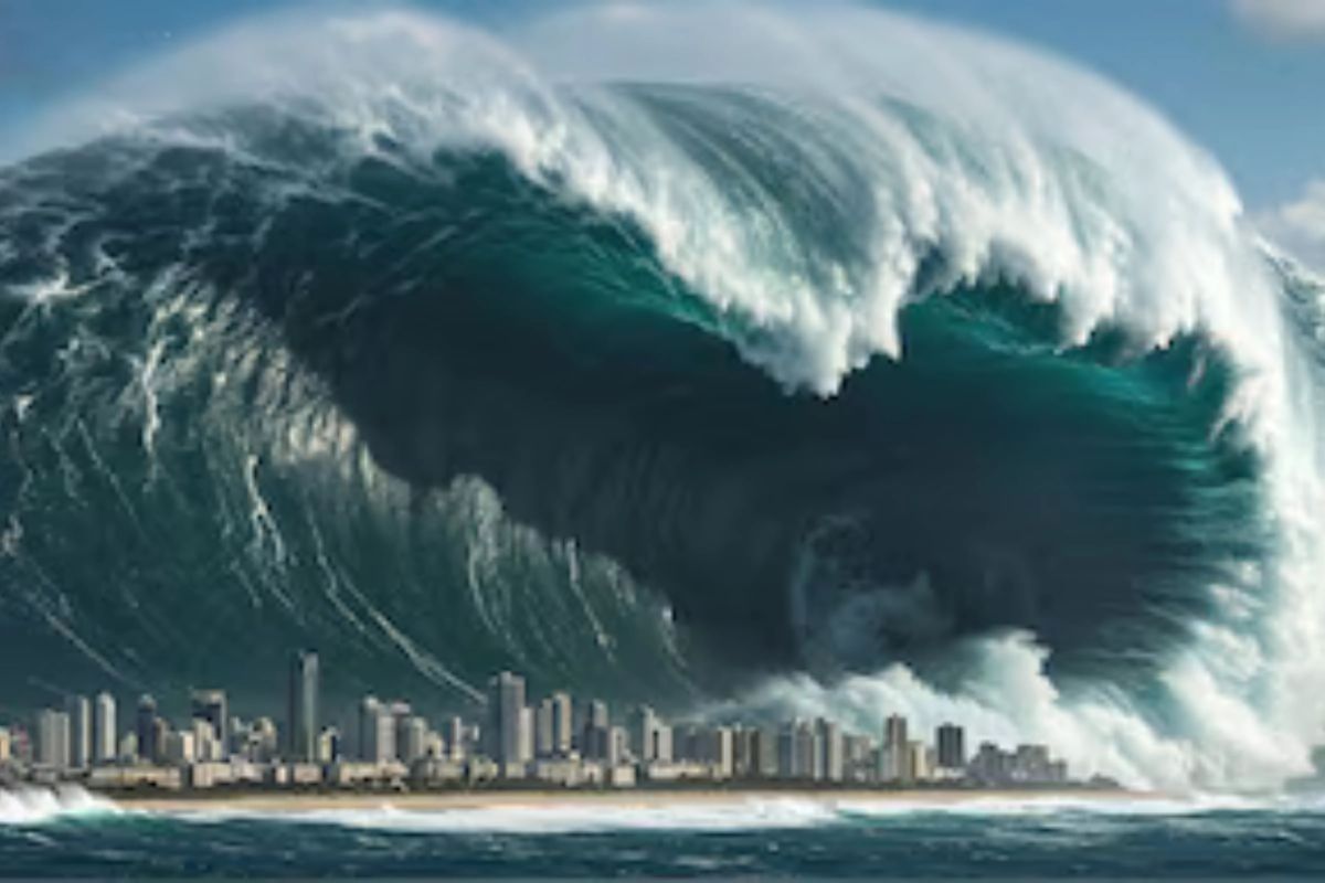
Imagine this: a massive wall of water, towering up to 1,000 feet high, crashing into the Pacific Northwest coast. Sounds like a nightmare, right? Well, scientists say it could happen, and sooner than we think. A recent study from Virginia Tech has everyone talking about the real risks from the Cascadia Subduction Zone. If a big earthquake hits there, it might trigger a mega-tsunami that could reshape entire coastlines.
We’re not talking about your average wave here. This is the kind of event that could submerge cities, flood roads, and change lives in an instant. But let’s break it down, step by step, without the hype. Just the facts from the latest research.
Understanding the Cascadia Subduction Zone: A Sleeping Giant Under the Pacific
Here’s the kicker: the Cascadia Subduction Zone isn’t some obscure fault line. It stretches about 600 miles, from Northern California up to Vancouver Island in Canada. Think of it as a massive crack where two huge pieces of the Earth’s crust grind against each other. The Juan de Fuca Plate oceanic plate is slowly sliding under the North American Plate. Over time, stress builds up. Kind of like winding a spring too tight. When it finally snaps, boom: a megathrust earthquake.
Scientists have been watching this zone for years. It’s one of North America’s most dangerous fault lines, capable of unleashing quakes over magnitude 8.0 or even 9.0. And believe it or not, the last big one happened back in 1700. That event sent tsunami waves all the way to Japan. Fast-forward to today. With cities packed along the coast, the stakes are higher than ever. Populations have grown, and infrastructure is everywhere. A repeat could be disastrous.
The Virginia Tech Study: New Warnings About a Potential Catastrophe
Enter the team from Virginia Tech, led by geoscientist Tina Dura. Their research, published in the Proceedings of the National Academy of Sciences, crunched thousands of simulations. What did they find? A 15 percent chance of a magnitude 8.0 or greater quake hitting the Cascadia zone in the next 50 years. That’s not a huge probability, but it’s enough to take seriously. If it happens, coastal land could suddenly drop by up to 6.5 feet. Subsidence, they call it. And that sinking would make floodplains expand dramatically, setting the stage for a mega-tsunami.
The study ran models showing how this drop would expose thousands more people, buildings, and miles of roads to flooding. We’re talking waves that could reach hundreds of potentially up to 1,000 feet, in the worst scenarios. Far beyond the few feet of a typical tsunami.
Tina Dura put it plainly: unlike slow sea-level rise from climate change, this would unfold in minutes. No time to adapt. The research emphasizes how current hazard maps might underestimate the risks, especially when you factor in that sudden land drop.
They didn’t stop at warnings. The team highlighted the need for better planning, like updated evacuation routes and stronger buildings. It’s a wake-up call, pure and simple.
What Makes a Mega-Tsunami So Different and Deadly?
Okay, let’s clarify something. Not all tsunamis are created equal. Your standard one might come from an undersea quake, pushing waves a few feet high that still cause havoc. But a mega-tsunami? That’s on another level. Triggered by massive displacements, a huge earthquake or landslides can generate waves stretching hundreds, even thousands, of feet tall. They travel fast, hit hard, and push miles inland.
In the Cascadia case, the combo of a big quake and land subsidence would amplify everything. Coastal areas sink, and water rushes in faster. Simulations show it could submerge low-lying zones permanently, especially with sea-level rise projected by 2100. Remember Lituya Bay in Alaska, 1958? A quake-triggered landslide sent a wave over 1,700 feet, the tallest recorded. No major cities there, thankfully. But imagine that near Seattle. Chilling.
The Virginia Tech folks stress this isn’t gradual. It’s sudden, catastrophic. And with millions living nearby, the human toll could be immense.
High-Risk Areas: Which US Regions Face the Greatest Threat?
The study pinpoints where the danger is highest. Southern Washington, northern Oregon, and northern California top the list. These spots are right along the fault line, vulnerable to the quake’s direct effects.
Cities like Seattle and Portland? They could be hit hard. Waves might wipe out neighborhoods, infrastructure. Portland’s not even on the coast, but rivers and expanded floodplains could carry the surge inland.
Then there’s Alaska and Hawaii. They’re farther out, but not immune. Both have their seismic hot spotsvolcanoes, and faults that could compound risks from distant waves. Alaska’s seen mega-tsunamis before, like in Lituya Bay.
Southern Washington might see the worst subsidence, dropping land and inviting floods. Northern California, too, with its rugged coast. The research maps out how thousands more structures could end up in harm’s way. It’s not just about the immediate hit. Long-term, we’re looking at displaced communities, ruined ecosystems, and economic fallout. Roads washed out, ports damaged. Recovery? Years, maybe decades.
Historical Context: Lessons from Past Cascadia Events
History has a way of repeating itself, doesn’t it? The 1700 Cascadia quake is a prime example. Estimated at magnitude 9.0, it ripped along the entire zone. Native American oral histories describe villages vanishing under waves.
Tsunami deposits found in Japan match the timingwaves crossed the Pacific. No dense cities back then, but the event reshaped coastlines.
Fast-forward to more recent scares. The 1964 Alaska quake triggered tsunamis that killed over a hundred. Or the 2004 Indian Ocean disaster: waves up to 100 feet, over 200,000 dead. Not Cascadia, but similar mechanics.
The USGS notes large tsunamis have hit the United States before, and will again. Pacific Rim quakes often spawn them. Cascadia’s overdue’s been 325 years since the last.
These past events inform today’s models. Scientists use sediment cores, tree rings, and even ghost forests (trees killed by subsidence) to piece together the puzzle. It’s how they estimate that 15 percent risk.
Potential Impacts: From Human Lives to Economic Devastation
- Picture the scene: a quake strikes, ground shakes violently. Minutes later, the coast drops. Then the waves come roaring in.
- Human cost first. Estimates suggest over 30,000 deaths are possible without prep. Evacuation? Tough in minutes. Low-lying areas flood instantly.
- Infrastructure takes a beating. Roads, bridges, and power lines are gone. Hospitals, schools in flood zones? Overwhelmed. The study predicts damage to over 170,000 structures, with costs exceeding $81 billion.
- Ecosystems suffer too. Wetlands drowned, wildlife displaced. Combined with climate change’s sea-level rise, some areas might never recover.
- Economically, it’s a nightmare. Ports like Seattle’s handle billions in trade. Shut them down, and ripples hit the whole US. Tourism, fishing industrieshammered.
- The social side: communities uprooted, mental health strains. Long-term displacement for thousands.
- Here’s the thing, though: it’s not inevitable doom. The study pushes for action to mitigate this.
Urgency of Preparedness: Building Resilience Against the Wave
Tina Dura and her team aren’t just scaring us. They’re urging change. Preparation today could dramatically reduce the human and economic costs.
What does that look like? Early-warning systems, for starters. Sensors detect quakes, alert phones in seconds. Give a few minutes to head for high ground.
- Evacuation planning: drills, marked routes. Communities in Washington and Oregon already practice “tsunami walks.”
- Resilient infrastructure: stronger buildings, elevated roads. Fortify hospitals, power grids.
- Urban planning matters. Avoid building in new floodplains identified by the study. Factor in subsidence risks.
- Federal and state agencies are on it. USGS, FEMA collaborate on maps, education. But the research says we need more updated models, including that land drop.
- Local governments: time to act. Policymakers and everyone play a part. Conduct drills, stock supplies. Knowledge saves lives.
Broader Implications: Climate Change and Compound Disasters
Funny thing is, this isn’t isolated. The study calls it a “compound disaster”: q quake plus a tsunami plus rising seas.
By 2100, sea levels could rise by more feet. Pair that with subsidence, and flood risks skyrocket. Low-lying zones become permanent underwater hazards.
It’s a reminder: natural disasters don’t happen in silos. Climate models now include seismic risks.
Globally, similar zones exist in Japan, Chile. Lessons from Cascadia could help worldwide.
If I’m honest, it’s a bit overwhelming. But science like this empowers us. We can’t stop the quake, but we can prepare.
Expert Voices: What Scientists Are Saying
- Lead researcher Tina Dura: “This could happen within minutes, leaving no time for adaptation or mitigation.”
- From the study: “Thousands more people, buildings, and miles of roads would be exposed to flooding than current hazard maps predict.”
- USGS experts echo: “Large tsunamis have occurred in the United States and will undoubtedly occur again.”
- These aren’t alarmists. They’re data-driven pros highlighting facts.
Looking Ahead: Monitoring and Mitigation Efforts
Monitoring tech advances. Seafloor sensors, GPS track plate movements. Helps refine predictions.
Mitigation: retrofitting buildings, creating tsunami-safe zones. Oregon’s passed laws for quake-resistant schools.
Public awareness campaigns. Apps for alerts, community workshops.
It’s ongoing. The 15 percent chance? That’s for the next 50 years, as of the study’s publication. We’re in 2025 now, time’s ticking.
Why This Matters Now: A Call to Awareness
So, why all the buzz? Because awareness leads to action. The Virginia Tech study isn’t just an academic blueprint for safety.
Cities like Seattle are already updating plans. Portland’s assessing river flood risks.
For everyday folks: know your zone. Have a go-bag. Stay informed.
Believe it or not, preparation turns a potential tragedy into a survivable event.
Final Thoughts on the Mega-Tsunami Threat
The Cascadia Subduction Zone looms large over the Pacific Northwest. A mega-tsunami from a major quake could bring waves up to 1,000 feet, sinking land and flooding coasts.
High-risk spots: southern Washington, northern Oregon, northern California. Alaska, Hawaii, too.
Historical quakes show it’s possible. Modern science quantifies the odds: 15 percent in 50 years.
But here’s the hopeful part: we can prepare. Stronger warnings, better planning, resilient communities.
It’s not about fear. It’s about facts and readiness. Stay vigilant, folks.